Mineral soils
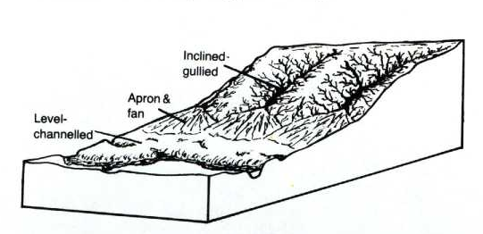
Aprons and Fans (a, f)
A fan is a gently sloping fan-shaped area resulting from the accumulation of sediments brought down by a stream descending through a deep ravine. A series of adjacent fans is called an apron. Fans and aprons are common in the Qu’Appelle Valley planes of stratification, indicative of their river or stream origin.
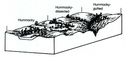
Hummocky (h)
Landscapes with a complex pattern of generally short steep slopes extending from prominent knolls to somewhat rounded depressions or kettles are termed hummocky. They are called hummocky dissected (hd) shallow gullies join one low area or kettle to the next and hummocky gullied (hg) numerous narrow ravines interrupt the hummocky features of the landscape. Occasionally, areas have a complex of ridged and hummocky features and are called hummocky ridged (hr).
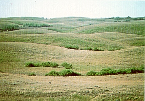
Hummocky landscapes have a very irregular surface form
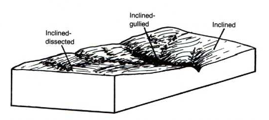
Inclined (i)
Landscapes in which the general slope is in one direction, only, are called inclined. Where shallow gullies occur along the slope, the areas are called inclined dissected (id). Where a series of deep gullies or ravines occur, they are called inclined gullied (ig).
Landscapes with a prevailing slope in one direction are called inclined
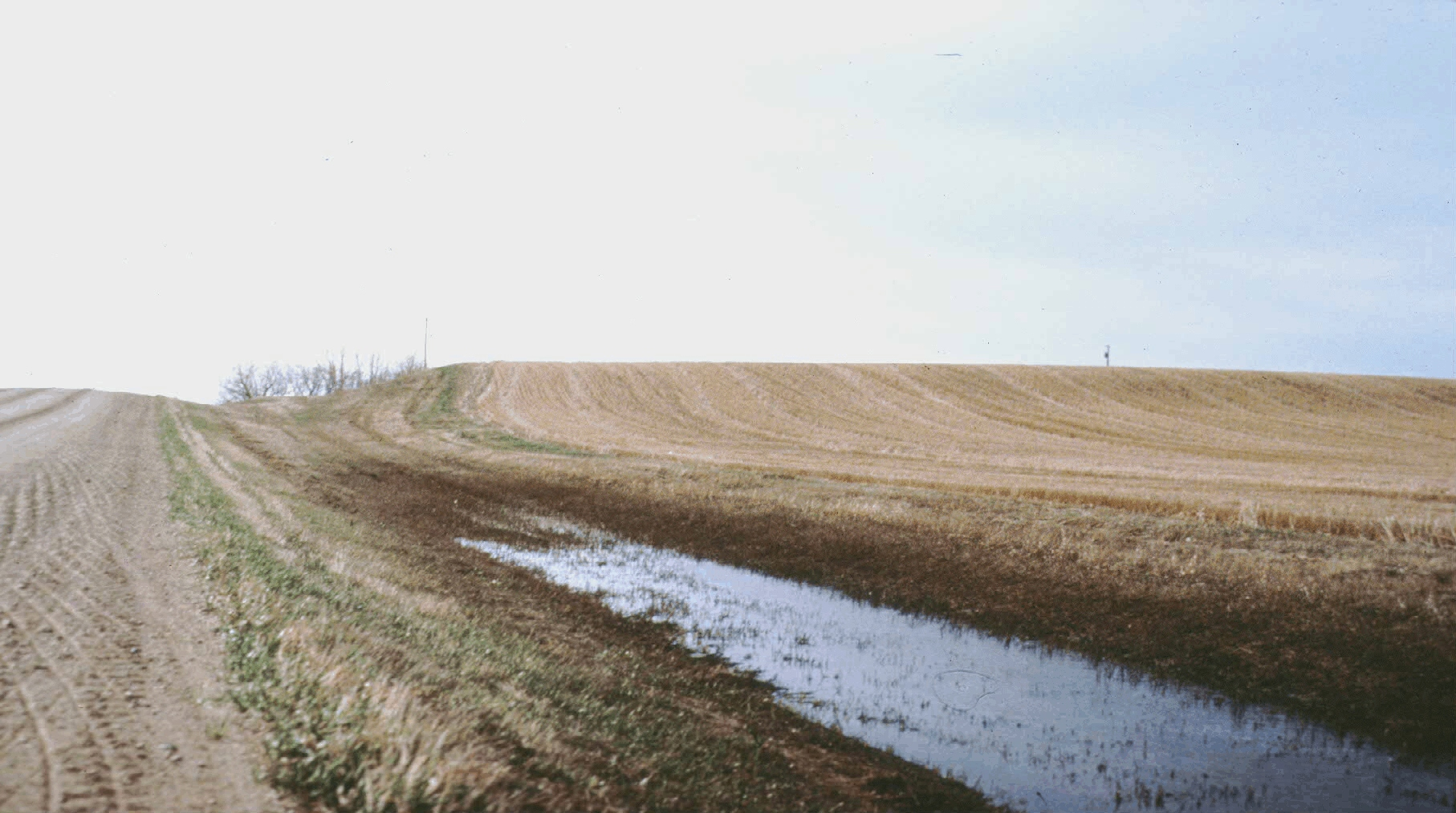
The above photograph illustrates a typical level landscape
Level (l)
Landscapes that are flat or have very gently sloping surfaces are said to be level. Along flood plains of rivers and streams where the level surface is broken by abandoned river channels they are called level channelled (lc).
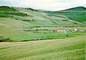
This landscape has occasional ridges in an otherwise undulating landscape with gentle slopes
Ridged (r)
Landscapes that have a linear pattern, usually of short and straight, parallel ridges but sometimes a single, sinuous ridge are called ridged. Some landscapes may have intersecting ridges.
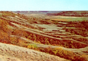
A rolling landscape with large macro-relief
Rolling (m)
Landscapes that are characterized by a sequence of long (often 1.6 km or greater), moderate to strong slopes extending from rounded, sometimes confined depressions to broad, rounded knolls, that impart a wavelike pattern to the land surface are called rolling. They are called rolling dissected (rd) where shallow gullies join one low area or kettle to the next.
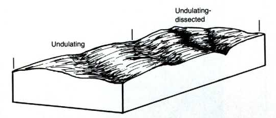
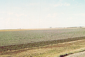
Undulating (u)
Landscapes that are characterized by a sequence of gentle slopes extending from smooth rises to gentle hollows, that impart a wave-like pattern to the land surface are called undulating. Where shallow gullies extend from one low area to the next in these landscapes they are called undulating dissected (ud) and where the undulating surface is broken by abandoned river channels they are called undulating channelled (uc).
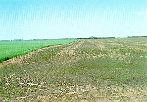
The crop field edge shows a wave-like pattern characteristic of an undulating landscape
Erosional modifiers (mineral soils)
An erosional modifier indicates a modifying erosional process that has occurred within the landscape since retreat of the glaciers. Three different erosional modifiers are used, and one of these modifiers may be added to the code designation for a specific surface form (such as hummocky, undulating, inclined and others).
Channelled (c)
Refers to abandoned meander channels or meander scars in the floodplain of a river. These abandoned meander channels may or may not be wet, and in many cases, tend to chop up otherwise valuable floodplains into small, tracts of land that are difficult or impossible to access and farm with machinery
Dissected (d)
Refers to relatively shallow surface drainageways or drainage networks that have developed on some landscapes. These subtle drainageways may be recognized in some landscapes, while in others, they can only be identified on aerial photographs. Numerous dissections in a landscape are a clear indication of the potential for rainfall to exit the landscape quickly into lakes or major streams, and in addition, to facilitate water erosion with the potential for significant soil to be moved from upper to lower slopes. Dissections are usually comparatively subtle landscape features and can be crossed readily with field implements.
Gullied - (g)
Refers to parallel and subparallel steep-sided, and narrow ravines that have developed from fluvial erosion on landscapes with strong to steep slopes. The gullies are typically deeply incised into the landscape so as to prevent farm implements from crossing such features.
Organic soils
Blanket (B)
A mantle of organic materials that is thick enough to mask minor irregularities in the underlying material but still conforms to the general underlying topography
Horizontal (H)
A flat peat surface that is not broken by marked elevations and depressions.
Bowl (O)
A bog or fen occupying concave-shaped depressions.
Ribbed (R)
A pattern of parallel low ridges associated with fens.